
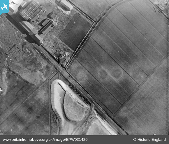
EPW031420 ENGLAND (1930). The Tillage Works quarry, Hook Pasture Lane and surrounding fields, Goole, 1930
© Copyright OpenStreetMap contributors and licensed by the OpenStreetMap Foundation. 2026. Cartography is licensed as CC BY-SA.
Nearby Images (11)
EPW031420

EAW046087

EAW046082

EAW046083

EAW046081

EAW046080

EAW022513

EAW046084

EAW046086

EPW031419

EAW046085

Details
| Title | [EPW031420] The Tillage Works quarry, Hook Pasture Lane and surrounding fields, Goole, 1930 |
| Reference | EPW031420 |
| Date | February-1930 |
| Link | |
| Place name | GOOLE |
| Parish | GOOLE |
| District | |
| Country | ENGLAND |
| Easting / Northing | 474073, 422420 |
| Longitude / Latitude | -0.87808418532707, 53.692738701941 |
| National Grid Reference | SE741224 |
Pins
Be the first to add a comment to this image!