
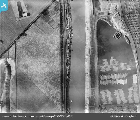
EPW031410 ENGLAND (1930). The Dutch River and the Timber Pond, Goole, 1930
© Copyright OpenStreetMap contributors and licensed by the OpenStreetMap Foundation. 2026. Cartography is licensed as CC BY-SA.
Nearby Images (3)
EPW031410

EPW031419

EPW031411

Details
| Title | [EPW031410] The Dutch River and the Timber Pond, Goole, 1930 |
| Reference | EPW031410 |
| Date | February-1930 |
| Link | |
| Place name | GOOLE |
| Parish | GOOLE |
| District | |
| Country | ENGLAND |
| Easting / Northing | 473755, 422582 |
| Longitude / Latitude | -0.88286108043216, 53.694239677475 |
| National Grid Reference | SE738226 |
Pins

Davethe |
Thursday 24th of July 2014 12:04:23 PM |