
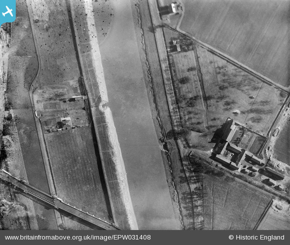
EPW031408 ENGLAND (1930). The Dutch River, South Airmyn Grange and the Knottingley and Goole Canal, Goole, 1930
© Copyright OpenStreetMap contributors and licensed by the OpenStreetMap Foundation. 2026. Cartography is licensed as CC BY-SA.
Nearby Images (3)
EPW031408

EPW031417

EPW031409

Details
| Title | [EPW031408] The Dutch River, South Airmyn Grange and the Knottingley and Goole Canal, Goole, 1930 |
| Reference | EPW031408 |
| Date | February-1930 |
| Link | |
| Place name | GOOLE |
| Parish | GOOLE |
| District | |
| Country | ENGLAND |
| Easting / Northing | 473270, 422405 |
| Longitude / Latitude | -0.89024751236341, 53.6927171667 |
| National Grid Reference | SE733224 |
Pins

John Wass |
Friday 20th of March 2015 09:02:49 PM | |
|
John Wass |
Friday 20th of March 2015 09:01:19 PM | |
MandM |
Sunday 16th of November 2014 04:35:43 PM | |
MandM |
Sunday 16th of November 2014 04:31:46 PM |
User Comment Contributions
This is the flood lock which can be closed to protect the canal at times of sea surge or unusual spring tides. |
MandM |
Sunday 16th of November 2014 04:33:52 PM |