
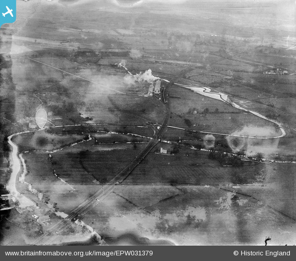
EPW031379 ENGLAND (1930). St Giles's Church, the Alpha Cement Works and surrounding countryside, Hampton Gay, from the south-east, 1930
© Copyright OpenStreetMap contributors and licensed by the OpenStreetMap Foundation. 2025. Cartography is licensed as CC BY-SA.
Nearby Images (2)
EPW031379

EPW031370

Details
| Title | [EPW031379] St Giles's Church, the Alpha Cement Works and surrounding countryside, Hampton Gay, from the south-east, 1930 |
| Reference | EPW031379 |
| Date | February-1930 |
| Link | |
| Place name | HAMPTON GAY |
| Parish | HAMPTON GAY AND POYLE |
| District | |
| Country | ENGLAND |
| Easting / Northing | 448449, 216251 |
| Longitude / Latitude | -1.2966629269002, 51.842313672017 |
| National Grid Reference | SP484163 |
Pins

Dylan Moore |
Monday 22nd of October 2012 09:54:35 PM |