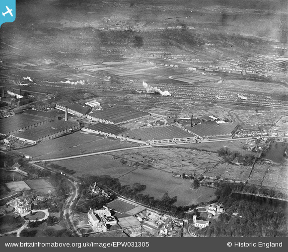
EPW031305 ENGLAND (1930). The Wolseley Motor Works and environs, Ward End, from the south-east, 1930
    © Copyright OpenStreetMap contributors and licensed by the OpenStreetMap Foundation. 2025. Cartography is licensed as CC BY-SA.
  
Details
| Title | [EPW031305] The Wolseley Motor Works and environs, Ward End, from the south-east, 1930 | 
| Reference | EPW031305 | 
| Date | March-1930 | 
| Link | |
| Place name | WARD END | 
| Parish | |
| District | |
| Country | ENGLAND | 
| Easting / Northing | 411164, 288803 | 
| Longitude / Latitude | -1.8355373440505, 52.496651833804 | 
| National Grid Reference | SP112888 | 
 
             
  ![[EPW031305] The Wolseley Motor Works and environs, Ward End, from the south-east, 1930](http://britainfromabove.org.uk/sites/all/libraries/aerofilms-images/public/100x100/EPW/031/EPW031305.jpg) 
  
                                          ![[EPW031300] The Wolseley Motor Works and the Midland Railway Carriage Works, Ward End, from the east, 1930](http://britainfromabove.org.uk/sites/all/libraries/aerofilms-images/public/100x100/EPW/031/EPW031300.jpg) 
 ![[EPW031302] The Wolseley Motor Works and St Margaret's Church, Ward End, from the east, 1930](http://britainfromabove.org.uk/sites/all/libraries/aerofilms-images/public/100x100/EPW/031/EPW031302.jpg) 
 ![[EPW031301] The Wolseley Motor Works and the Midland Railway Carriage Works, Ward End, 1930](http://britainfromabove.org.uk/sites/all/libraries/aerofilms-images/public/100x100/EPW/031/EPW031301.jpg) 
  Washwood Heath Road
 Washwood Heath Road