
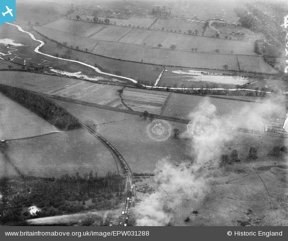
EPW031288 ENGLAND (1930). The junction of the Rickmansworth and Croxley Mills Branch Lines, Northwood, 1930. This image has been produced from a damaged negative.
© Copyright OpenStreetMap contributors and licensed by the OpenStreetMap Foundation. 2026. Cartography is licensed as CC BY-SA.
Nearby Images (2)
EPW031288

EPR000489

Details
| Title | [EPW031288] The junction of the Rickmansworth and Croxley Mills Branch Lines, Northwood, 1930. This image has been produced from a damaged negative. |
| Reference | EPW031288 |
| Date | 11-February-1930 |
| Link | |
| Place name | NORTHWOOD |
| Parish | |
| District | |
| Country | ENGLAND |
| Easting / Northing | 508578, 194715 |
| Longitude / Latitude | -0.43074550223942, 51.640276329049 |
| National Grid Reference | TQ086947 |
Pins
 |

Pdadme |
Saturday 23rd of November 2019 01:55:39 PM |

LesMead |
Thursday 16th of May 2013 11:20:11 AM | |
|
LesMead |
Wednesday 8th of May 2013 11:37:58 AM | |

Class31 |
Monday 22nd of October 2012 12:27:35 PM | |
|
Class31 |
Thursday 18th of October 2012 11:25:06 PM | |
|
Class31 |
Thursday 18th of October 2012 11:22:44 PM | |
|
Class31 |
Thursday 18th of October 2012 11:19:03 PM | |
|
Class31 |
Thursday 18th of October 2012 11:18:38 PM | |
|
Class31 |
Thursday 18th of October 2012 11:17:28 PM | |
|
Class31 |
Thursday 18th of October 2012 11:16:49 PM |