
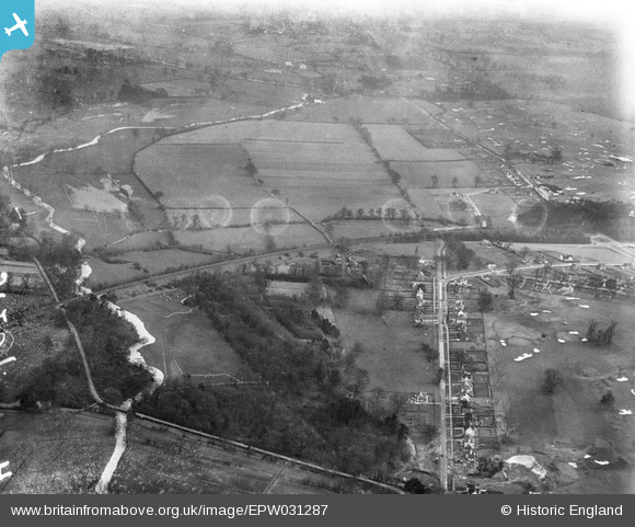
EPW031287 ENGLAND (1930). Tolpits Lane, Moor Farm and environs, Moor Park, 1930. This image has been produced from a damaged negative.
© Copyright OpenStreetMap contributors and licensed by the OpenStreetMap Foundation. 2026. Cartography is licensed as CC BY-SA.
Nearby Images (3)
EPW031287

EPW031290

EAW004066

Details
| Title | [EPW031287] Tolpits Lane, Moor Farm and environs, Moor Park, 1930. This image has been produced from a damaged negative. |
| Reference | EPW031287 |
| Date | 11-February-1930 |
| Link | |
| Place name | MOOR PARK |
| Parish | |
| District | |
| Country | ENGLAND |
| Easting / Northing | 508357, 193943 |
| Longitude / Latitude | -0.43417733208047, 51.633379502015 |
| National Grid Reference | TQ084939 |
Pins

LesMead |
Saturday 15th of March 2014 07:14:07 PM | |
|
LesMead |
Saturday 15th of March 2014 07:14:03 PM | |

Class31 |
Monday 22nd of October 2012 12:26:19 PM | |
|
Class31 |
Saturday 20th of October 2012 09:56:16 PM | |
|
Class31 |
Saturday 20th of October 2012 09:55:09 PM | |
|
Class31 |
Friday 19th of October 2012 08:49:36 PM | |
|
Class31 |
Thursday 18th of October 2012 11:27:10 PM | |
|
Class31 |
Thursday 18th of October 2012 11:25:51 PM | |
|
Class31 |
Thursday 18th of October 2012 10:35:55 PM | |
|
Class31 |
Thursday 18th of October 2012 10:35:10 PM |

