
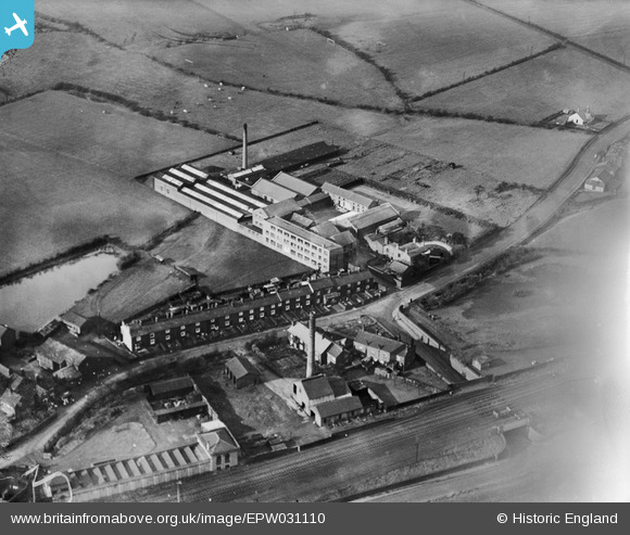
EPW031110 ENGLAND (1929). Stothert's Albion Drugs and Drysaltery Works, Atherton, 1929
© Copyright OpenStreetMap contributors and licensed by the OpenStreetMap Foundation. 2026. Cartography is licensed as CC BY-SA.
Nearby Images (10)
EPW031110

EPR000579

EPR000574

EPW031182

EPR000577

EPR000575

EPW031127

EPW031114

EPW031115

EPR000576

Details
| Title | [EPW031110] Stothert's Albion Drugs and Drysaltery Works, Atherton, 1929 |
| Reference | EPW031110 |
| Date | October-1929 |
| Link | |
| Place name | ATHERTON |
| Parish | |
| District | |
| Country | ENGLAND |
| Easting / Northing | 366635, 404036 |
| Longitude / Latitude | -2.5034218602372, 53.5316737007 |
| National Grid Reference | SD666040 |
Pins
Be the first to add a comment to this image!