
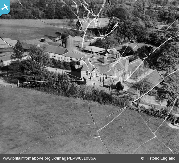
EPW031086A ENGLAND (1929). Ecchinswell House, Ecchinswell, 1929. This image has been produced from a damaged negative.
© Copyright OpenStreetMap contributors and licensed by the OpenStreetMap Foundation. 2026. Cartography is licensed as CC BY-SA.
Nearby Images (3)
EPW031086A

EPW031088

EPW031087A

Details
| Title | [EPW031086A] Ecchinswell House, Ecchinswell, 1929. This image has been produced from a damaged negative. |
| Reference | EPW031086A |
| Date | October-1929 |
| Link | |
| Place name | ECCHINSWELL |
| Parish | ECCHINSWELL, SYDMONTON AND BISHOPS GREEN |
| District | |
| Country | ENGLAND |
| Easting / Northing | 450247, 160231 |
| Longitude / Latitude | -1.2785868169449, 51.338442655175 |
| National Grid Reference | SU502602 |
Pins
Be the first to add a comment to this image!
User Comment Contributions
Ecchinswell House, near Newbury. |

Tony D |
Tuesday 2nd of July 2013 11:47:03 AM |
Thanks for the location for this image. We'll update the catalogue and post the new record here in due course. Yours, Katy Britain from Above Cataloguing Team Leader |
Katy Whitaker |
Tuesday 2nd of July 2013 11:47:03 AM |
One of a series of 10 photos, EPW031086A, EPW031087A, EPW031088-EPW031091 and EPW031093-EPW031096. Manor House 2 appears to be the focus as it is featured in three closeups (EPW031086A, EPW031087A, EPW031088) so this may have been where the air meet was based. |
Rebecca |
Wednesday 9th of January 2013 04:24:34 PM |
Manor House 2. |
Rebecca |
Wednesday 9th of January 2013 04:24:29 PM |