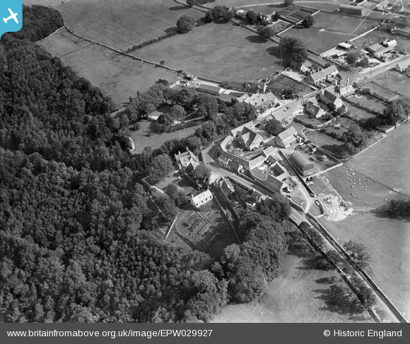
EPW029927 ENGLAND (1929). The village, Birdlip, 1929
© Copyright OpenStreetMap contributors and licensed by the OpenStreetMap Foundation. 2024. Cartography is licensed as CC BY-SA.
Details
| Title | [EPW029927] The village, Birdlip, 1929 |
| Reference | EPW029927 |
| Date | September-1929 |
| Link | |
| Place name | BIRDLIP |
| Parish | COWLEY |
| District | |
| Country | ENGLAND |
| Easting / Northing | 392472, 214384 |
| Longitude / Latitude | -2.1092481361903, 51.827577487683 |
| National Grid Reference | SO925144 |
Pins
 gerry-r |
Saturday 28th of September 2024 12:45:16 PM |


![[EPW029927] The village, Birdlip, 1929](http://britainfromabove.org.uk/sites/all/libraries/aerofilms-images/public/100x100/EPW/029/EPW029927.jpg)
![[EPW029929] The village, Birdlip, 1929. This image has been produced from a copy-negative.](http://britainfromabove.org.uk/sites/all/libraries/aerofilms-images/public/100x100/EPW/029/EPW029929.jpg)
![[EPW029928] The village, Birdlip, 1929](http://britainfromabove.org.uk/sites/all/libraries/aerofilms-images/public/100x100/EPW/029/EPW029928.jpg)
![[EPW029926] The village, Birdlip, 1929](http://britainfromabove.org.uk/sites/all/libraries/aerofilms-images/public/100x100/EPW/029/EPW029926.jpg)