
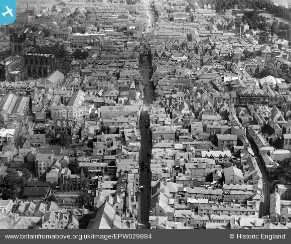
EPW029884 ENGLAND (1929). Watergate Street and Eastgate Street, Chester, 1929
© Copyright OpenStreetMap contributors and licensed by the OpenStreetMap Foundation. 2026. Cartography is licensed as CC BY-SA.
Nearby Images (28)
EPW029884

EPW058010

EPW037241

EPW040164

EPW058009

EPW003097

EPW005884

EPW058002

EPW029885

EPW005883

EPW003093

EPW036910

EPW004008

EPW004003

EPW029883

EPW029881

EPW037240

EAW013772

EPW029886

EPW005885

EPW040162

EPW036909

EPW004006

EPW011199

EPW011200

EPW004007

EAW013771

EPW058007

Details
| Title | [EPW029884] Watergate Street and Eastgate Street, Chester, 1929 |
| Reference | EPW029884 |
| Date | September-1929 |
| Link | |
| Place name | CHESTER |
| Parish | |
| District | |
| Country | ENGLAND |
| Easting / Northing | 340490, 366278 |
| Longitude / Latitude | -2.8907583864547, 53.18997180371 |
| National Grid Reference | SJ405663 |


