
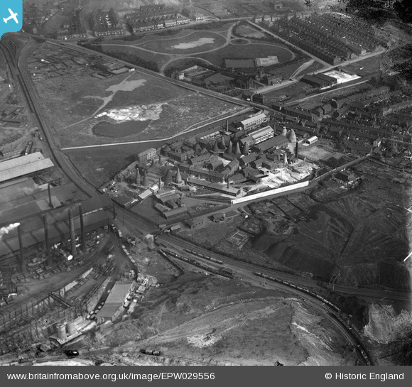
EPW029556 ENGLAND (1929). Josiah Wedgwood Etruria Potteries, Etruria, 1929
© Copyright OpenStreetMap contributors and licensed by the OpenStreetMap Foundation. 2026. Cartography is licensed as CC BY-SA.
Nearby Images (5)
EPW029556

EPW029555

EPW029553

EPW029557

EPW029554

Details
| Title | [EPW029556] Josiah Wedgwood Etruria Potteries, Etruria, 1929 |
| Reference | EPW029556 |
| Date | September-1929 |
| Link | |
| Place name | ETRURIA |
| Parish | |
| District | |
| Country | ENGLAND |
| Easting / Northing | 386759, 347383 |
| Longitude / Latitude | -2.1974271183173, 53.02327055246 |
| National Grid Reference | SJ868474 |
Pins

GB |
Sunday 17th of September 2023 01:27:59 PM | |
|
GB |
Sunday 17th of September 2023 01:26:46 PM | |
|
GB |
Sunday 17th of September 2023 01:25:14 PM | |
|
GB |
Sunday 17th of September 2023 01:24:35 PM | |
|
GB |
Sunday 17th of September 2023 01:23:36 PM | |
|
GB |
Sunday 17th of September 2023 01:23:05 PM | |
|
GB |
Sunday 17th of September 2023 01:22:34 PM | |
|
GB |
Sunday 17th of September 2023 01:21:10 PM | |
|
GB |
Sunday 17th of September 2023 01:20:35 PM | |
|
GB |
Sunday 17th of September 2023 01:19:31 PM | |
|
GB |
Sunday 17th of September 2023 01:18:49 PM | |
|
gbaddley |
Thursday 7th of November 2013 07:30:41 PM | |
|
gbaddley |
Thursday 7th of November 2013 07:03:44 PM |