
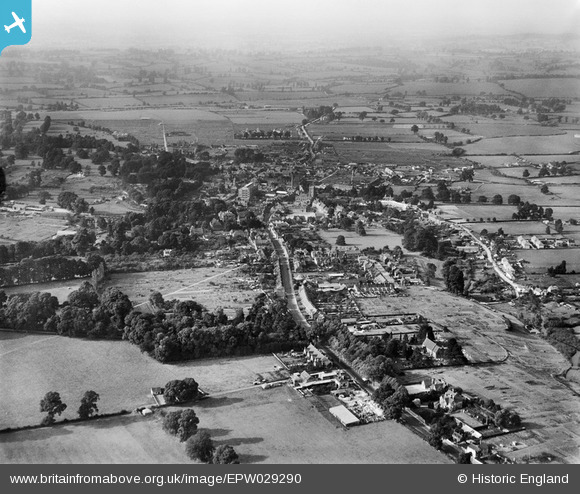
EPW029290 ENGLAND (1929). The town, Calne, from the south-east, 1929
© Copyright OpenStreetMap contributors and licensed by the OpenStreetMap Foundation. 2026. Cartography is licensed as CC BY-SA.
Nearby Images (3)
EPW029290

EPW033525

EPW029291

Details
| Title | [EPW029290] The town, Calne, from the south-east, 1929 |
| Reference | EPW029290 |
| Date | 14-September-1929 |
| Link | |
| Place name | CALNE |
| Parish | CALNE |
| District | |
| Country | ENGLAND |
| Easting / Northing | 400171, 170215 |
| Longitude / Latitude | -1.997539981517, 51.430446900804 |
| National Grid Reference | SU002702 |
Pins

Steve Bedding |
Friday 14th of June 2013 01:18:05 PM | |

Pilot |
Sunday 28th of April 2013 07:41:54 PM |