
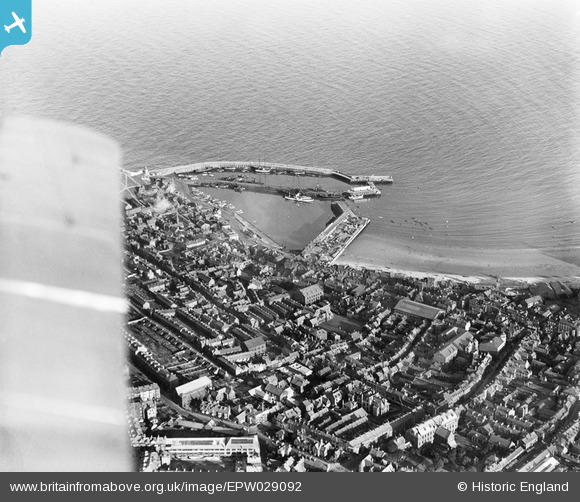
EPW029092 ENGLAND (1929). The Old Harbour and town centre, Scarborough, from the north-west, 1929
© Copyright OpenStreetMap contributors and licensed by the OpenStreetMap Foundation. 2026. Cartography is licensed as CC BY-SA.
Nearby Images (3)
EPW029092

EAW016689

EAW007952

Details
| Title | [EPW029092] The Old Harbour and town centre, Scarborough, from the north-west, 1929 |
| Reference | EPW029092 |
| Date | 12-September-1929 |
| Link | |
| Place name | SCARBOROUGH |
| Parish | |
| District | |
| Country | ENGLAND |
| Easting / Northing | 504492, 488892 |
| Longitude / Latitude | -0.39471037275487, 54.284806471148 |
| National Grid Reference | TA045889 |
Pins

mannidaze |
Sunday 24th of October 2021 02:37:33 PM | |

Mullenaround |
Thursday 18th of February 2021 11:21:39 PM | |
|
Mullenaround |
Thursday 18th of February 2021 11:20:57 PM | |

Captain ants |
Sunday 24th of May 2020 10:39:16 AM | |
|
Chris101 |
Tuesday 16th of April 2019 06:39:09 PM | |
|
Chris101 |
Tuesday 16th of April 2019 06:38:49 PM | |
Lynda Tubbs |
Tuesday 18th of March 2014 12:28:59 PM | |

Alan McFaden |
Tuesday 16th of July 2013 09:49:01 AM | |
|
Alan McFaden |
Tuesday 16th of July 2013 09:48:28 AM | |
|
Alan McFaden |
Tuesday 16th of July 2013 09:47:23 AM |


