
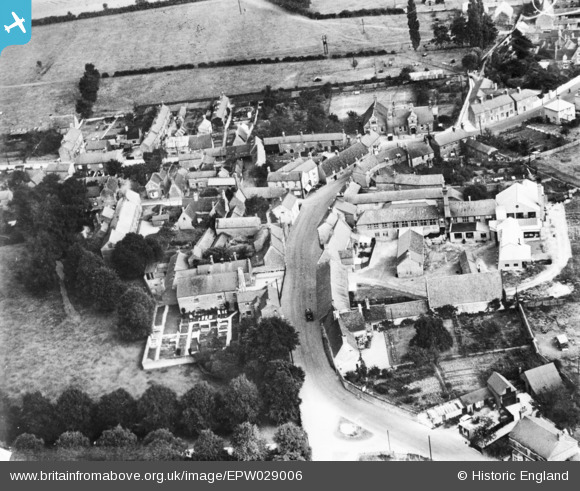
EPW029006 ENGLAND (1929). The High Street, Harrold, 1929. This image has been produced from a copy-negative.
© Copyright OpenStreetMap contributors and licensed by the OpenStreetMap Foundation. 2025. Cartography is licensed as CC BY-SA.
Nearby Images (3)
EPW029006

EPW029005

EPW029009

Details
| Title | [EPW029006] The High Street, Harrold, 1929. This image has been produced from a copy-negative. |
| Reference | EPW029006 |
| Date | 6-September-1929 |
| Link | |
| Place name | HARROLD |
| Parish | HARROLD |
| District | |
| Country | ENGLAND |
| Easting / Northing | 494877, 256891 |
| Longitude / Latitude | -0.61155733739314, 52.201670757166 |
| National Grid Reference | SP949569 |
Pins
Be the first to add a comment to this image!