
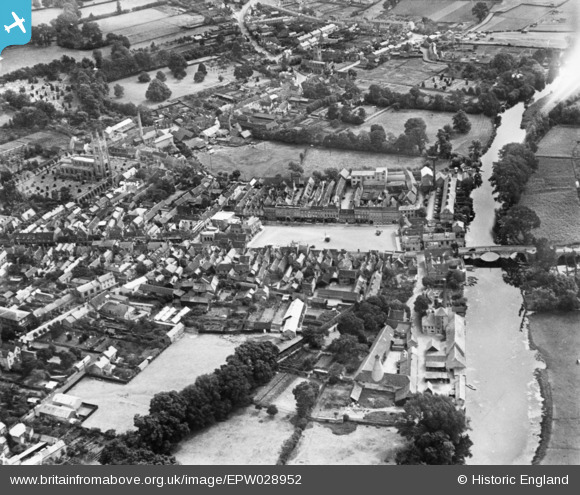
EPW028952 ENGLAND (1929). The town centre, St Neots, 1929. This image has been produced from a copy-negative.
© Copyright OpenStreetMap contributors and licensed by the OpenStreetMap Foundation. 2026. Cartography is licensed as CC BY-SA.
Nearby Images (10)
EPW028952

EAW033047

EAW033052

EAW033049

EAW033050

EAW033053

EAW033051

EAW003728

EAW033048

EAW003729

Details
| Title | [EPW028952] The town centre, St Neots, 1929. This image has been produced from a copy-negative. |
| Reference | EPW028952 |
| Date | September-1929 |
| Link | |
| Place name | ST NEOTS |
| Parish | ST. NEOTS |
| District | |
| Country | ENGLAND |
| Easting / Northing | 518239, 260226 |
| Longitude / Latitude | -0.26866176583541, 52.227126904735 |
| National Grid Reference | TL182602 |
Pins

H.E. |
Thursday 24th of April 2025 01:05:42 PM | |
 |
JonB |
Monday 11th of December 2017 07:22:24 PM |

melgibbs |
Wednesday 18th of March 2015 06:49:17 PM | |
|
melgibbs |
Wednesday 18th of March 2015 06:48:41 PM |