
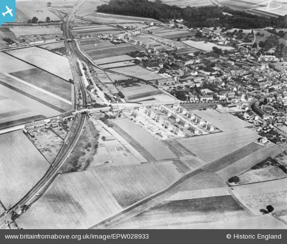
EPW028933 ENGLAND (1929). Oak Crescent and environs, Potton, 1929. This image has been produced from a copy-negative.
© Copyright OpenStreetMap contributors and licensed by the OpenStreetMap Foundation. 2026. Cartography is licensed as CC BY-SA.
Nearby Images (2)
EPW028933

EPW028931

Details
| Title | [EPW028933] Oak Crescent and environs, Potton, 1929. This image has been produced from a copy-negative. |
| Reference | EPW028933 |
| Date | September-1929 |
| Link | |
| Place name | POTTON |
| Parish | POTTON |
| District | |
| Country | ENGLAND |
| Easting / Northing | 521936, 249151 |
| Longitude / Latitude | -0.21853773746899, 52.126788400097 |
| National Grid Reference | TL219492 |
Pins

BG123 |
Tuesday 29th of August 2017 05:25:15 PM | |
|
John W |
Friday 21st of October 2016 07:44:56 PM |