
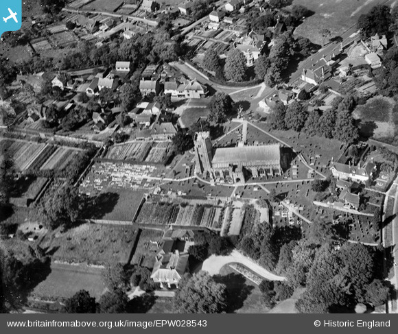
EPW028543 ENGLAND (1929). St Laurence's Church and environs, The Moor, 1929
© Copyright OpenStreetMap contributors and licensed by the OpenStreetMap Foundation. 2025. Cartography is licensed as CC BY-SA.
Nearby Images (2)
EPW028543

EPW028547

Details
| Title | [EPW028543] St Laurence's Church and environs, The Moor, 1929 |
| Reference | EPW028543 |
| Date | August-1929 |
| Link | |
| Place name | THE MOOR |
| Parish | HAWKHURST |
| District | |
| Country | ENGLAND |
| Easting / Northing | 575576, 129442 |
| Longitude / Latitude | 0.50456146436992, 51.036937754994 |
| National Grid Reference | TQ756294 |
Pins
Be the first to add a comment to this image!
User Comment Contributions
This is the first time I've seen our house from this angle! It's a marvellous picture, and shows the churchyard at the western end still half-empty as well (it's full now)! So many fields are built on nowadays too! |

Scrobs |
Thursday 10th of January 2013 08:55:55 PM |