
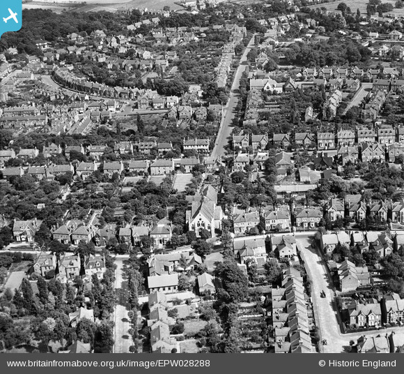
EPW028288 ENGLAND (1929). Granville Road and environs, Sidcup, 1929
© Copyright OpenStreetMap contributors and licensed by the OpenStreetMap Foundation. 2026. Cartography is licensed as CC BY-SA.
Nearby Images (2)
EPW028288

EPW028282

Details
| Title | [EPW028288] Granville Road and environs, Sidcup, 1929 |
| Reference | EPW028288 |
| Date | August-1929 |
| Link | |
| Place name | SIDCUP |
| Parish | |
| District | |
| Country | ENGLAND |
| Easting / Northing | 546273, 172004 |
| Longitude / Latitude | 0.10427028788357, 51.427646376233 |
| National Grid Reference | TQ463720 |
Pins

martynrb |
Friday 31st of October 2025 03:42:18 PM | |

Barney |
Tuesday 29th of January 2019 07:29:57 AM | |
|
Barney |
Tuesday 29th of January 2019 07:29:19 AM | |
|
Barney |
Tuesday 29th of January 2019 07:28:38 AM | |
|
Barney |
Tuesday 29th of January 2019 07:27:32 AM | |
|
Broom1 |
Tuesday 16th of February 2016 09:43:43 PM | |
|
Barney |
Friday 14th of November 2014 08:00:47 AM | |
|
Barney |
Friday 14th of November 2014 08:00:28 AM | |
|
Barney |
Friday 14th of November 2014 07:55:11 AM | |
|
Gone2Kent |
Sunday 2nd of February 2014 06:21:47 PM |
