
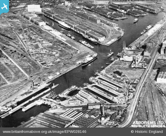
EPW028146 ENGLAND (1929). The Manchester Ship Canal and Salford Docks, Salford, 1929. This image has been produced from a copy-negative.
© Copyright OpenStreetMap contributors and licensed by the OpenStreetMap Foundation. 2026. Cartography is licensed as CC BY-SA.
Nearby Images (8)
EPW028146

EAW017330

EAW017315

EAW017320

EAW017319

EAW017314

EAW017317

EAW050419

Details
| Title | [EPW028146] The Manchester Ship Canal and Salford Docks, Salford, 1929. This image has been produced from a copy-negative. |
| Reference | EPW028146 |
| Date | 19-July-1929 |
| Link | |
| Place name | SALFORD |
| Parish | |
| District | |
| Country | ENGLAND |
| Easting / Northing | 380131, 397301 |
| Longitude / Latitude | -2.299367140461, 53.471814392423 |
| National Grid Reference | SJ801973 |
Pins
Be the first to add a comment to this image!