
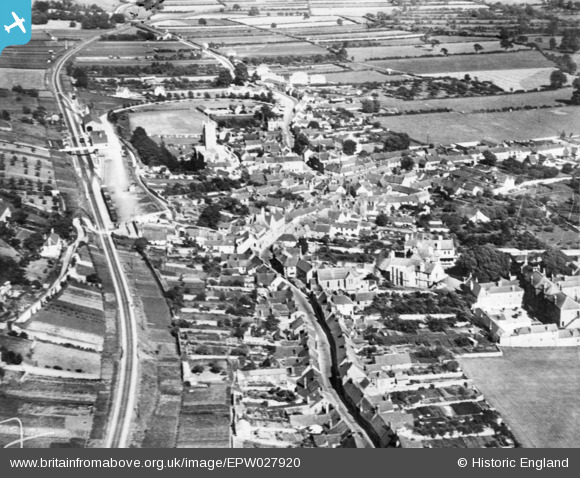
EPW027920 ENGLAND (1929). The town, Axbridge, 1929. This image has been produced from a copy-negative.
© Copyright OpenStreetMap contributors and licensed by the OpenStreetMap Foundation. 2026. Cartography is licensed as CC BY-SA.
Nearby Images (2)
EPW027920

EPW027924

Details
| Title | [EPW027920] The town, Axbridge, 1929. This image has been produced from a copy-negative. |
| Reference | EPW027920 |
| Date | June-1929 |
| Link | |
| Place name | AXBRIDGE |
| Parish | AXBRIDGE |
| District | |
| Country | ENGLAND |
| Easting / Northing | 342983, 154589 |
| Longitude / Latitude | -2.81770001484, 51.287071619869 |
| National Grid Reference | ST430546 |
Pins

clippedwings |
Wednesday 11th of February 2015 08:56:04 PM | |

Class31 |
Wednesday 11th of February 2015 11:39:53 AM | |
|
Class31 |
Wednesday 11th of February 2015 11:35:50 AM | |
|
Class31 |
Wednesday 11th of February 2015 11:34:08 AM | |
|
Class31 |
Wednesday 11th of February 2015 11:22:27 AM | |
|
Class31 |
Wednesday 11th of February 2015 11:20:06 AM | |
|
Class31 |
Wednesday 11th of February 2015 11:17:45 AM |


User Comment Contributions

King John's Hunting Lodge, Axbridge is Grade II* listed, 10/02/2015 |
Class31 |
Wednesday 11th of February 2015 11:30:59 AM |