
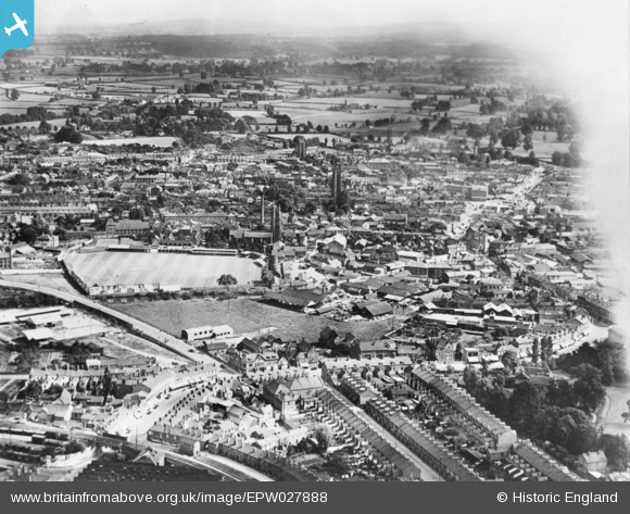
EPW027888 ENGLAND (1929). The town, Taunton, from the north, 1929. This image has been produced from a copy-negative.
© Copyright OpenStreetMap contributors and licensed by the OpenStreetMap Foundation. 2026. Cartography is licensed as CC BY-SA.
Nearby Images (2)
EPW027888

EPW027896

Details
| Title | [EPW027888] The town, Taunton, from the north, 1929. This image has been produced from a copy-negative. |
| Reference | EPW027888 |
| Date | 28-June-1929 |
| Link | |
| Place name | TAUNTON |
| Parish | |
| District | |
| Country | ENGLAND |
| Easting / Northing | 322675, 125142 |
| Longitude / Latitude | -3.1025646320602, 51.019907185406 |
| National Grid Reference | ST227251 |
Pins

mosstyn |
Tuesday 10th of November 2020 09:57:26 PM | |
|
Somerset Chick |
Sunday 19th of March 2017 12:22:32 AM | |
|
Somerset Chick |
Sunday 19th of March 2017 12:21:43 AM | |
|
Somerset Chick |
Sunday 19th of March 2017 12:20:22 AM | |
|
Somerset Chick |
Sunday 19th of March 2017 12:19:50 AM |