
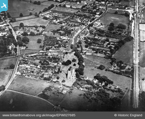
EPW027685 ENGLAND (1929). The village, Headcorn, 1929. This image has been produced from a damaged copy-negative.
© Copyright OpenStreetMap contributors and licensed by the OpenStreetMap Foundation. 2026. Cartography is licensed as CC BY-SA.
Nearby Images (2)
EPW027685

EPW027684

Details
| Title | [EPW027685] The village, Headcorn, 1929. This image has been produced from a damaged copy-negative. |
| Reference | EPW027685 |
| Date | 23-June-1929 |
| Link | |
| Place name | HEADCORN |
| Parish | HEADCORN |
| District | |
| Country | ENGLAND |
| Easting / Northing | 583295, 144224 |
| Longitude / Latitude | 0.62205805897466, 51.167324705867 |
| National Grid Reference | TQ833442 |
Pins

Railway Routes |
Thursday 31st of August 2023 09:19:51 PM | |
|
Railway Routes |
Thursday 31st of August 2023 09:18:33 PM |