
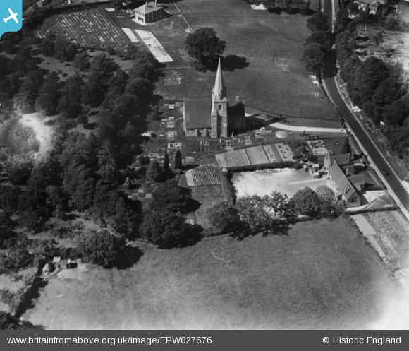
EPW027676 ENGLAND (1929). St Michael's Church, St Michaels, 1929. This image has been produced from a print.
© Copyright OpenStreetMap contributors and licensed by the OpenStreetMap Foundation. 2026. Cartography is licensed as CC BY-SA.
Nearby Images (2)
EPW027676

EPW027678

Details
| Title | [EPW027676] St Michael's Church, St Michaels, 1929. This image has been produced from a print. |
| Reference | EPW027676 |
| Date | 23-June-1929 |
| Link | |
| Place name | ST MICHAELS |
| Parish | TENTERDEN |
| District | |
| Country | ENGLAND |
| Easting / Northing | 588447, 135354 |
| Longitude / Latitude | 0.69103440514737, 51.085970017034 |
| National Grid Reference | TQ884354 |
Pins

Kentishman |
Tuesday 19th of January 2016 05:27:57 PM |