
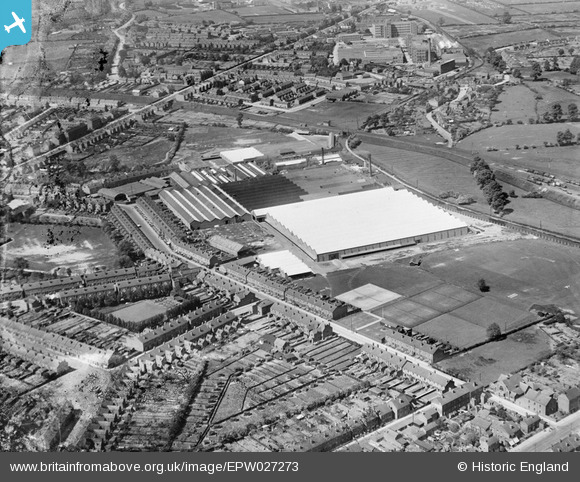
EPW027273 ENGLAND (1929). The Alfred Herbet Edgwick Machine Tool Works, Edgwick, 1929
© Copyright OpenStreetMap contributors and licensed by the OpenStreetMap Foundation. 2026. Cartography is licensed as CC BY-SA.
Nearby Images (2)
EPW027273

EPW001180

Details
| Title | [EPW027273] The Alfred Herbet Edgwick Machine Tool Works, Edgwick, 1929 |
| Reference | EPW027273 |
| Date | 31-May-1929 |
| Link | |
| Place name | EDGWICK |
| Parish | |
| District | |
| Country | ENGLAND |
| Easting / Northing | 434668, 281560 |
| Longitude / Latitude | -1.490050670035, 52.430544608787 |
| National Grid Reference | SP347816 |
Pins

Steve Rarity |
Sunday 5th of January 2020 01:36:34 PM | |
|
Darren |
Saturday 20th of April 2019 02:56:56 AM | |
|
Steve S |
Monday 6th of July 2015 05:16:28 AM | |
|
Steve S |
Monday 6th of July 2015 05:15:38 AM | |
|
Steve S |
Monday 6th of July 2015 05:05:08 AM | |
|
Steve S |
Sunday 5th of July 2015 01:53:38 PM | |
|
Steve S |
Sunday 5th of July 2015 01:50:48 PM | |
|
Steve S |
Sunday 5th of July 2015 01:49:33 PM | |
|
Steve S |
Sunday 5th of July 2015 01:48:28 PM | |
|
Steve S |
Sunday 5th of July 2015 01:47:33 PM | |
|
Steve S |
Sunday 5th of July 2015 01:46:48 PM | |
|
Steve S |
Sunday 5th of July 2015 01:45:45 PM | |
|
Steve S |
Sunday 5th of July 2015 01:44:46 PM |