
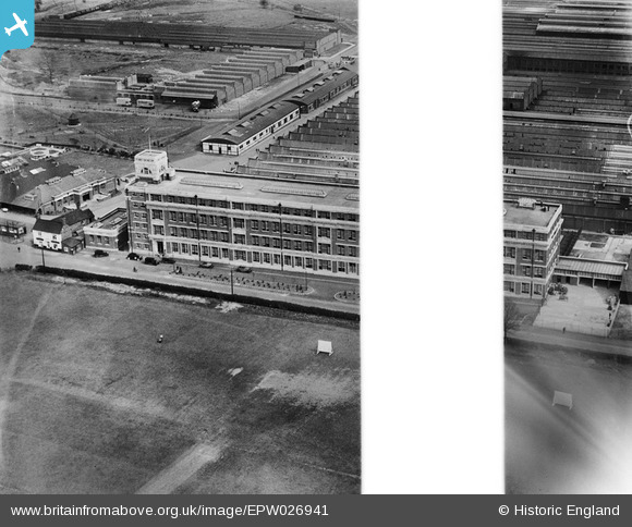
EPW026941 ENGLAND (1929). Fort Dunlop Rubber Works, Bromford, 1929. This image was marked by Aerofilms Ltd for photo editing.
© Copyright OpenStreetMap contributors and licensed by the OpenStreetMap Foundation. 2026. Cartography is licensed as CC BY-SA.
Nearby Images (14)
EPW026941

EPW026933

EPW026936

EPW026934

EPW026935

EPW026943

EPW026938

EPW026940

EPW001206

EPW053751

EPW026937

EPW026939

EPW025791

EPW038603

Details
| Title | [EPW026941] Fort Dunlop Rubber Works, Bromford, 1929. This image was marked by Aerofilms Ltd for photo editing. |
| Reference | EPW026941 |
| Date | May-1929 |
| Link | |
| Place name | BROMFORD |
| Parish | |
| District | |
| Country | ENGLAND |
| Easting / Northing | 412374, 290579 |
| Longitude / Latitude | -1.8176462361987, 52.512593600096 |
| National Grid Reference | SP124906 |
Pins
Be the first to add a comment to this image!