
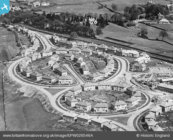
EPW026546A ENGLAND (1929). The Castle Grove housing estate under construction, Kendal, 1929
© Copyright OpenStreetMap contributors and licensed by the OpenStreetMap Foundation. 2025. Cartography is licensed as CC BY-SA.
Nearby Images (6)
EPW026546A

EPW038840

EPW038839

EPW026757

EPW026758

EPW026546

Details
| Title | [EPW026546A] The Castle Grove housing estate under construction, Kendal, 1929 |
| Reference | EPW026546A |
| Date | May-1929 |
| Link | |
| Place name | KENDAL |
| Parish | KENDAL |
| District | |
| Country | ENGLAND |
| Easting / Northing | 352535, 492380 |
| Longitude / Latitude | -2.7298754677674, 54.324633837461 |
| National Grid Reference | SD525924 |
Pins

John Wass |
Sunday 1st of November 2015 07:56:20 PM |