
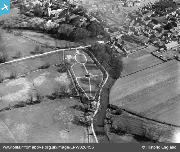
EPW026456 ENGLAND (1929). Franklin Recreation Ground, Biggleswade, 1929
© Copyright OpenStreetMap contributors and licensed by the OpenStreetMap Foundation. 2026. Cartography is licensed as CC BY-SA.
Nearby Images (3)
EPW026456

EPW026455

EPW026457

Details
| Title | [EPW026456] Franklin Recreation Ground, Biggleswade, 1929 |
| Reference | EPW026456 |
| Date | May-1929 |
| Link | |
| Place name | BIGGLESWADE |
| Parish | BIGGLESWADE |
| District | |
| Country | ENGLAND |
| Easting / Northing | 518748, 244316 |
| Longitude / Latitude | -0.26677638284248, 52.084028286247 |
| National Grid Reference | TL187443 |
Pins

John W |
Friday 27th of January 2017 08:22:58 PM | |
|
John W |
Friday 27th of January 2017 08:21:30 PM | |
|
John W |
Friday 27th of January 2017 08:20:32 PM | |
|
Archivist |
Friday 18th of December 2015 08:12:01 AM | |
|
Archivist |
Friday 18th of December 2015 08:10:45 AM |