
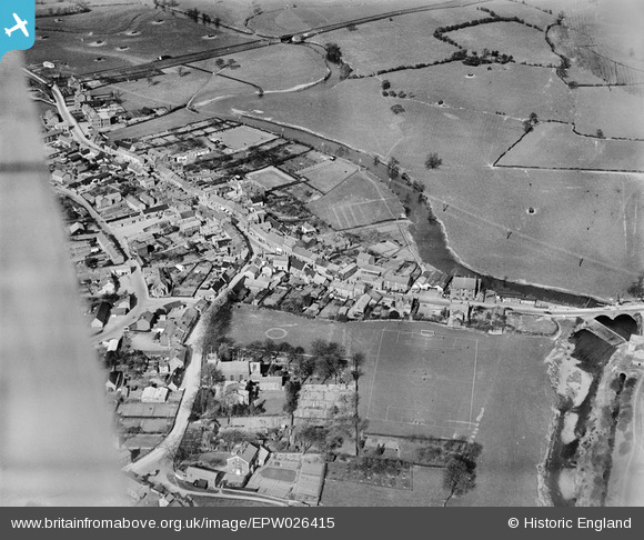
EPW026415 ENGLAND (1929). The town, Garstang, 1929
© Copyright OpenStreetMap contributors and licensed by the OpenStreetMap Foundation. 2026. Cartography is licensed as CC BY-SA.
Nearby Images (5)
EPW026415

EPW026412

EPW026414

EPW026411

EPW026410

Details
| Title | [EPW026415] The town, Garstang, 1929 |
| Reference | EPW026415 |
| Date | April-1929 |
| Link | |
| Place name | GARSTANG |
| Parish | GARSTANG |
| District | |
| Country | ENGLAND |
| Easting / Northing | 349229, 445123 |
| Longitude / Latitude | -2.7727672286341, 53.899583169089 |
| National Grid Reference | SD492451 |
Pins
Be the first to add a comment to this image!