
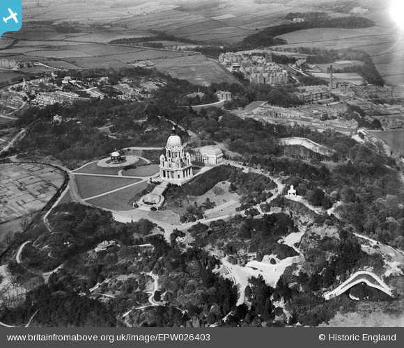
EPW026403 ENGLAND (1929). Williamson Park and the Ashton Memorial, Lancaster, 1929
© Copyright OpenStreetMap contributors and licensed by the OpenStreetMap Foundation. 2026. Cartography is licensed as CC BY-SA.
Nearby Images (10)
EPW026403

EAW023409

EAW005628

EAW023408

EPW029181

EPW042039

EPW042040

EAW005627

EPW002085

EPW002082

Details
| Title | [EPW026403] Williamson Park and the Ashton Memorial, Lancaster, 1929 |
| Reference | EPW026403 |
| Date | April-1929 |
| Link | |
| Place name | LANCASTER |
| Parish | |
| District | |
| Country | ENGLAND |
| Easting / Northing | 348939, 461327 |
| Longitude / Latitude | -2.7798956865758, 54.045194949621 |
| National Grid Reference | SD489613 |
Pins
Lynda Tubbs |
Tuesday 1st of April 2014 02:01:35 PM | |
Lynda Tubbs |
Tuesday 1st of April 2014 01:54:08 PM | |
Lynda Tubbs |
Tuesday 1st of April 2014 01:50:25 PM | |
Lynda Tubbs |
Tuesday 1st of April 2014 12:17:14 PM | |
Lynda Tubbs |
Tuesday 1st of April 2014 12:15:03 PM |