
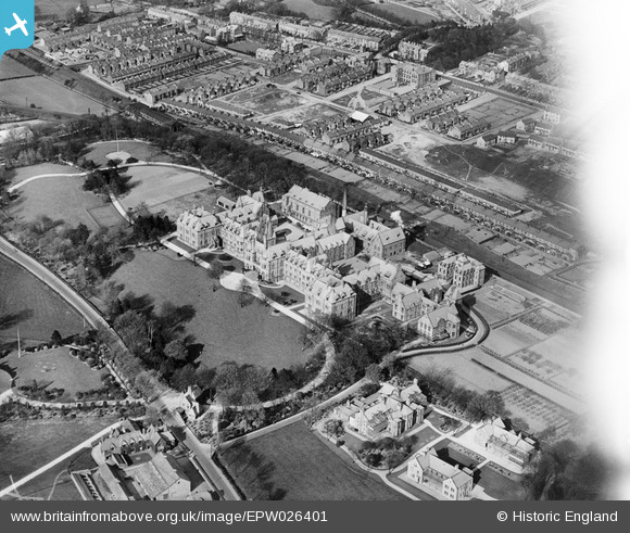
EPW026401 ENGLAND (1929). The Royal Albert Psychiatric Hospital and housing off Dorrington Road, Lancaster, 1929
© Copyright OpenStreetMap contributors and licensed by the OpenStreetMap Foundation. 2026. Cartography is licensed as CC BY-SA.
Nearby Images (2)
EPW026401

EPW026400

Details
| Title | [EPW026401] The Royal Albert Psychiatric Hospital and housing off Dorrington Road, Lancaster, 1929 |
| Reference | EPW026401 |
| Date | April-1929 |
| Link | |
| Place name | LANCASTER |
| Parish | |
| District | |
| Country | ENGLAND |
| Easting / Northing | 347679, 460019 |
| Longitude / Latitude | -2.7989131689724, 54.033312611306 |
| National Grid Reference | SD477600 |
Pins

tim birch |
Friday 17th of January 2020 01:14:44 PM | |
|
Lcas.int |
Friday 12th of October 2018 08:48:09 PM | |
|
lesgilpin |
Wednesday 29th of April 2015 05:40:45 PM | |
|
lesgilpin |
Wednesday 29th of April 2015 05:39:33 PM |