
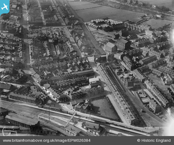
EPW026384 ENGLAND (1929). Housing off King Street and Queen Street, Earlestown, 1929
© Copyright OpenStreetMap contributors and licensed by the OpenStreetMap Foundation. 2026. Cartography is licensed as CC BY-SA.
Nearby Images (6)
EPW026384

EPW026383

EPW026382

EPW026387

EPW026388

EPW026385

Details
| Title | [EPW026384] Housing off King Street and Queen Street, Earlestown, 1929 |
| Reference | EPW026384 |
| Date | April-1929 |
| Link | |
| Place name | EARLESTOWN |
| Parish | |
| District | |
| Country | ENGLAND |
| Easting / Northing | 357652, 395238 |
| Longitude / Latitude | -2.6377643641848, 53.451941842106 |
| National Grid Reference | SJ577952 |
Pins

Peter |
Tuesday 17th of April 2018 09:14:58 PM | |
|
Dave |
Tuesday 12th of November 2013 12:46:23 PM |