
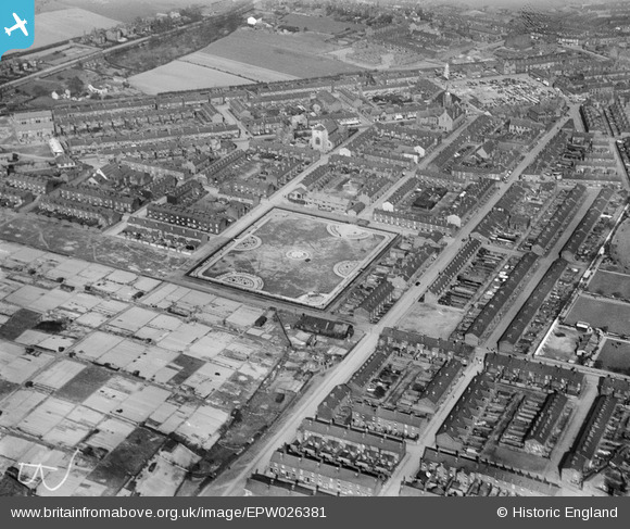
EPW026381 ENGLAND (1929). Housing off Legh Street, St John's Play Ground and St John the Baptist's Church, Earlestown, 1929
© Copyright OpenStreetMap contributors and licensed by the OpenStreetMap Foundation. 2026. Cartography is licensed as CC BY-SA.
Nearby Images (2)
EPW026381

EPW026386

Details
| Title | [EPW026381] Housing off Legh Street, St John's Play Ground and St John the Baptist's Church, Earlestown, 1929 |
| Reference | EPW026381 |
| Date | April-1929 |
| Link | |
| Place name | EARLESTOWN |
| Parish | |
| District | |
| Country | ENGLAND |
| Easting / Northing | 357120, 395309 |
| Longitude / Latitude | -2.645785454576, 53.452537025049 |
| National Grid Reference | SJ571953 |
Pins

Dave |
Thursday 31st of October 2013 12:38:03 PM |