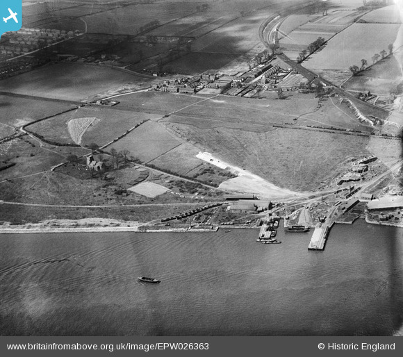
EPW026363 ENGLAND (1929). Housing off Manor Road and St Clement's Church, South Stifford, 1929
© Copyright OpenStreetMap contributors and licensed by the OpenStreetMap Foundation. 2026. Cartography is licensed as CC BY-SA.
Details
| Title | [EPW026363] Housing off Manor Road and St Clement's Church, South Stifford, 1929 |
| Reference | EPW026363 |
| Date | April-1929 |
| Link | |
| Place name | SOUTH STIFFORD |
| Parish | |
| District | |
| Country | ENGLAND |
| Easting / Northing | 559452, 177362 |
| Longitude / Latitude | 0.29612042229181, 51.472234806015 |
| National Grid Reference | TQ595774 |
Pins
Be the first to add a comment to this image!


![[EPW026363] Housing off Manor Road and St Clement's Church, South Stifford, 1929](http://britainfromabove.org.uk/sites/all/libraries/aerofilms-images/public/100x100/EPW/026/EPW026363.jpg)
![[EAW053107] Hedley Soap Works, West Thurrock, 1954](http://britainfromabove.org.uk/sites/all/libraries/aerofilms-images/public/100x100/EAW/053/EAW053107.jpg)
![[EPW026337] Gibb's Cement Works and Thames Cement Works, South Stifford, 1929](http://britainfromabove.org.uk/sites/all/libraries/aerofilms-images/public/100x100/EPW/026/EPW026337.jpg)
![[EPW026360] The Lion Cement Works, Gibb's Cement Works and surrounding countryside, South Stifford, from the south, 1929](http://britainfromabove.org.uk/sites/all/libraries/aerofilms-images/public/100x100/EPW/026/EPW026360.jpg)