
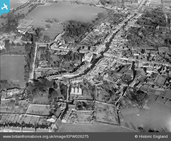
EPW026275 ENGLAND (1929). St Peter's Church and the town centre, Chertsey, 1929
© Copyright OpenStreetMap contributors and licensed by the OpenStreetMap Foundation. 2026. Cartography is licensed as CC BY-SA.
Nearby Images (7)
EPW026275

EPW023379

EPW023378

EPW026282

EPW049548

EPW023376

EPW026277

Details
| Title | [EPW026275] St Peter's Church and the town centre, Chertsey, 1929 |
| Reference | EPW026275 |
| Date | 25-April-1929 |
| Link | |
| Place name | CHERTSEY |
| Parish | |
| District | |
| Country | ENGLAND |
| Easting / Northing | 504148, 167007 |
| Longitude / Latitude | -0.50293666779861, 51.392036231124 |
| National Grid Reference | TQ041670 |

