
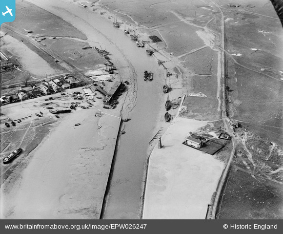
EPW026247 ENGLAND (1929). The Landing Stage, moorings and lighthouse, Rye Harbour, 1929
© Copyright OpenStreetMap contributors and licensed by the OpenStreetMap Foundation. 2025. Cartography is licensed as CC BY-SA.
Nearby Images (3)
EPW026247

EPW026249

EPW026248

Details
| Title | [EPW026247] The Landing Stage, moorings and lighthouse, Rye Harbour, 1929 |
| Reference | EPW026247 |
| Date | 25-April-1929 |
| Link | |
| Place name | RYE HARBOUR |
| Parish | ICKLESHAM |
| District | |
| Country | ENGLAND |
| Easting / Northing | 594315, 119134 |
| Longitude / Latitude | 0.76603920791984, 50.9383122522 |
| National Grid Reference | TQ943191 |
Pins
 Nearholmer |
Friday 19th of February 2021 09:52:39 PM | |
gBr |
Sunday 11th of December 2016 10:08:45 PM | |
oversands |
Tuesday 11th of December 2012 04:06:22 PM | |
oversands |
Tuesday 11th of December 2012 04:05:10 PM | |
oversands |
Tuesday 11th of December 2012 04:04:26 PM | |
Closed 1939 or 1940. |
John W |
Sunday 11th of December 2016 08:42:34 PM |