
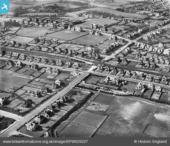
EPW026227 ENGLAND (1929). West Bexhill (Collington) Halt and surrounding residential area, Bexhill, 1929
© Copyright OpenStreetMap contributors and licensed by the OpenStreetMap Foundation. 2026. Cartography is licensed as CC BY-SA.
Nearby Images (2)
EPW026227
 Halt and surrounding residential area, Bexhill, 1929")
EPW000692

Details
| Title | [EPW026227] West Bexhill (Collington) Halt and surrounding residential area, Bexhill, 1929 |
| Reference | EPW026227 |
| Date | 24-April-1929 |
| Link | |
| Place name | BEXHILL |
| Parish | |
| District | |
| Country | ENGLAND |
| Easting / Northing | 573146, 107261 |
| Longitude / Latitude | 0.45939073768241, 50.838377906247 |
| National Grid Reference | TQ731073 |
Pins

Smugdane |
Friday 10th of December 2021 05:58:13 PM | |
|
Smugdane |
Friday 10th of December 2021 05:57:18 PM | |
|
Smugdane |
Friday 10th of December 2021 05:55:35 PM | |
|
Pamela |
Tuesday 29th of December 2020 06:46:17 PM | |
|
John W |
Saturday 11th of June 2016 04:51:47 PM | |
|
John W |
Saturday 11th of June 2016 04:48:17 PM | |
|
John W |
Saturday 11th of June 2016 04:46:53 PM | |
One of the first such bridges apparently erected in 1913 to replace the level crossing here. It was erected by the local authority not the railway co (L.B.&S.C.R.) and remains the responsibility of the Highway Authority to this day. The bridge lights are part of the area street lights. |
Alan Dengate |
Monday 25th of November 2019 05:00:26 PM |
|
JL |
Saturday 26th of April 2014 10:41:22 AM |