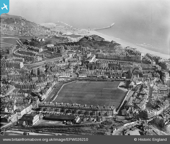
EPW026210 ENGLAND (1929). The Central Cricket and Recreation Ground and environs, Hastings, from the north-west, 1929
    © Copyright OpenStreetMap contributors and licensed by the OpenStreetMap Foundation. 2025. Cartography is licensed as CC BY-SA.
  
Details
| Title | [EPW026210] The Central Cricket and Recreation Ground and environs, Hastings, from the north-west, 1929 | 
| Reference | EPW026210 | 
| Date | 24-May-1929 | 
| Link | |
| Place name | HASTINGS | 
| Parish | |
| District | |
| Country | ENGLAND | 
| Easting / Northing | 581682, 109631 | 
| Longitude / Latitude | 0.58168477482893, 50.857053824989 | 
| National Grid Reference | TQ817096 | 
Pins
Be the first to add a comment to this image!
 
             
  ![[EPW026210] The Central Cricket and Recreation Ground and environs, Hastings, from the north-west, 1929](http://britainfromabove.org.uk/sites/all/libraries/aerofilms-images/public/100x100/EPW/026/EPW026210.jpg) 
  
                                          ![[EAW022976] The Central Cricket and Recreation Ground, Hastings Railway Station and the town, Hastings, 1949](http://britainfromabove.org.uk/sites/all/libraries/aerofilms-images/public/100x100/EAW/022/EAW022976.jpg) 
 ![[EPW000740] Hastings Station, Hastings, from the north-east, 1920](http://britainfromabove.org.uk/sites/all/libraries/aerofilms-images/public/100x100/EPW/000/EPW000740.jpg) 
 ![[EPW035340] Wellington Square and Castle Hill, Hastings, 1931. This image has been produced from a copy-negative.](http://britainfromabove.org.uk/sites/all/libraries/aerofilms-images/public/100x100/EPW/035/EPW035340.jpg)