
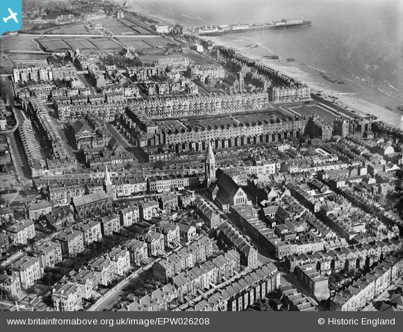
EPW026208 ENGLAND (1929). Christ Church, Warrior Square and environs, Hastings, 1929
© Copyright OpenStreetMap contributors and licensed by the OpenStreetMap Foundation. 2026. Cartography is licensed as CC BY-SA.
Nearby Images (9)
EPW026208

EPW000109

EPW026190

EPW000117

EPW026207

EPW016890

EAW022977

EAW002413

EPW042838

Details
| Title | [EPW026208] Christ Church, Warrior Square and environs, Hastings, 1929 |
| Reference | EPW026208 |
| Date | 24-April-1929 |
| Link | |
| Place name | HASTINGS |
| Parish | |
| District | |
| Country | ENGLAND |
| Easting / Northing | 580367, 109167 |
| Longitude / Latitude | 0.56279015397587, 50.85329668163 |
| National Grid Reference | TQ804092 |
Pins

leigh kennedy |
Saturday 18th of June 2016 09:48:25 PM | |
|
leigh kennedy |
Saturday 18th of June 2016 09:38:02 PM | |
|
leigh kennedy |
Saturday 18th of June 2016 09:31:42 PM |


User Comment Contributions

Elite cinema |
leigh kennedy |
Saturday 18th of June 2016 09:45:49 PM |