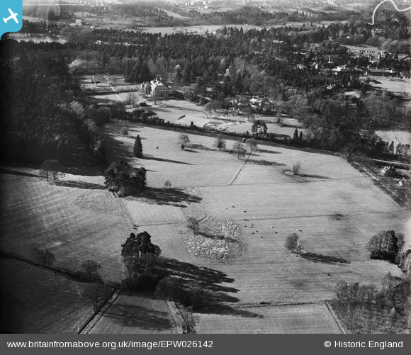
EPW026142 ENGLAND (1929). Englemere, Ascot, 1929
© Copyright OpenStreetMap contributors and licensed by the OpenStreetMap Foundation. 2026. Cartography is licensed as CC BY-SA.
Nearby Images (9)
Details
| Title | [EPW026142] Englemere, Ascot, 1929 |
| Reference | EPW026142 |
| Date | April-1929 |
| Link | |
| Place name | ASCOT |
| Parish | SUNNINGHILL AND ASCOT |
| District | |
| Country | ENGLAND |
| Easting / Northing | 491305, 168237 |
| Longitude / Latitude | -0.68717459422468, 51.405306876966 |
| National Grid Reference | SU913682 |
Pins
Be the first to add a comment to this image!


![[EPW026142] Englemere, Ascot, 1929](http://britainfromabove.org.uk/sites/all/libraries/aerofilms-images/public/100x100/EPW/026/EPW026142.jpg)
![[EPW026146] Englemere, Ascot, 1929](http://britainfromabove.org.uk/sites/all/libraries/aerofilms-images/public/100x100/EPW/026/EPW026146.jpg)
![[EPW026147] Englemere, Ascot, 1929](http://britainfromabove.org.uk/sites/all/libraries/aerofilms-images/public/100x100/EPW/026/EPW026147.jpg)
![[EPW026149] Englemere, Ascot, 1929](http://britainfromabove.org.uk/sites/all/libraries/aerofilms-images/public/100x100/EPW/026/EPW026149.jpg)
![[EPW026144] Englemere House, Ascot, 1929](http://britainfromabove.org.uk/sites/all/libraries/aerofilms-images/public/100x100/EPW/026/EPW026144.jpg)
![[EPW026141] Englemere, Ascot, 1929](http://britainfromabove.org.uk/sites/all/libraries/aerofilms-images/public/100x100/EPW/026/EPW026141.jpg)
![[EPW026143] Englemere House, Ascot, 1929](http://britainfromabove.org.uk/sites/all/libraries/aerofilms-images/public/100x100/EPW/026/EPW026143.jpg)
![[EPW026148] Englemere House, Ascot, 1929](http://britainfromabove.org.uk/sites/all/libraries/aerofilms-images/public/100x100/EPW/026/EPW026148.jpg)
![[EPW026151] Englemere House, Ascot, 1929](http://britainfromabove.org.uk/sites/all/libraries/aerofilms-images/public/100x100/EPW/026/EPW026151.jpg)