
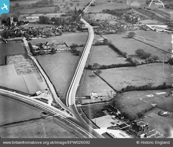
EPW026092 ENGLAND (1929). The Southern By-pass and the village, Charing, 1929
© Copyright OpenStreetMap contributors and licensed by the OpenStreetMap Foundation. 2025. Cartography is licensed as CC BY-SA.
Nearby Images (2)
EPW026092

EPW026055

Details
| Title | [EPW026092] The Southern By-pass and the village, Charing, 1929 |
| Reference | EPW026092 |
| Date | April-1929 |
| Link | |
| Place name | CHARING |
| Parish | CHARING |
| District | |
| Country | ENGLAND |
| Easting / Northing | 594971, 149583 |
| Longitude / Latitude | 0.79178800299752, 51.211600159051 |
| National Grid Reference | TQ950496 |
Pins

Kent Navigator |
Friday 20th of October 2017 05:36:05 PM | |
|
Kent Navigator |
Friday 20th of October 2017 05:33:34 PM | |
|
Kent Navigator |
Friday 20th of October 2017 05:32:40 PM | |
|
MB |
Friday 26th of October 2012 12:59:47 PM | |
|
MB |
Friday 26th of October 2012 12:59:13 PM | |
|
MB |
Friday 26th of October 2012 12:58:43 PM | |
|
MB |
Friday 26th of October 2012 12:57:51 PM | |
|
MB |
Friday 26th of October 2012 12:57:23 PM | |
|
MB |
Friday 26th of October 2012 12:56:59 PM | |
|
MB |
Friday 26th of October 2012 12:56:29 PM | |
|
MB |
Friday 26th of October 2012 12:55:32 PM | |
|
MB |
Friday 26th of October 2012 12:55:12 PM | |
|
MB |
Friday 26th of October 2012 12:53:38 PM | |
|
MB |
Friday 26th of October 2012 12:50:38 PM | |
|
MB |
Friday 26th of October 2012 12:50:00 PM | |
|
MB |
Friday 26th of October 2012 12:49:38 PM |