
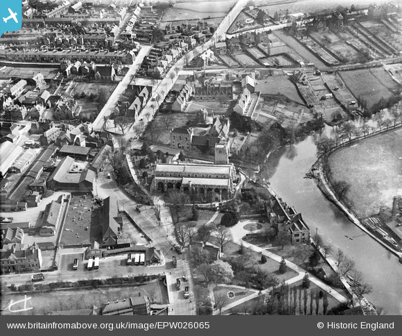
EPW026065 ENGLAND (1929). All Saints' Church and environs, Maidstone, 1929
© Copyright OpenStreetMap contributors and licensed by the OpenStreetMap Foundation. 2026. Cartography is licensed as CC BY-SA.
Nearby Images (6)
EPW026065

EPW005630

EPW016897

EPW005632

EPW026067

EPW009208

Details
| Title | [EPW026065] All Saints' Church and environs, Maidstone, 1929 |
| Reference | EPW026065 |
| Date | April-1929 |
| Link | |
| Place name | MAIDSTONE |
| Parish | |
| District | |
| Country | ENGLAND |
| Easting / Northing | 576009, 155378 |
| Longitude / Latitude | 0.5234172702738, 51.269823506836 |
| National Grid Reference | TQ760554 |
Pins

academy100 |
Saturday 8th of March 2014 09:15:30 AM | |
|
Steve |
Wednesday 28th of November 2012 09:18:44 PM | |
|
Steve |
Wednesday 28th of November 2012 09:17:44 PM | |
|
Steve |
Wednesday 28th of November 2012 09:10:13 PM | |
|
Steve |
Wednesday 28th of November 2012 09:07:53 PM |