
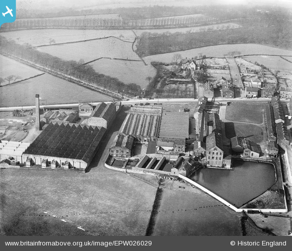
EPW026029 ENGLAND (1929). Lydgate and Clover Greaves Woollen Mills, Calverley, 1929
© Copyright OpenStreetMap contributors and licensed by the OpenStreetMap Foundation. 2026. Cartography is licensed as CC BY-SA.
Nearby Images (10)
EPW026029

EPW026030

EPW026034

EPW026003

EPW026028

EPW026031

EPW026027

EPW026032

EPW026033

EPW026004

Details
| Title | [EPW026029] Lydgate and Clover Greaves Woollen Mills, Calverley, 1929 |
| Reference | EPW026029 |
| Date | 6-April-1929 |
| Link | |
| Place name | CALVERLEY |
| Parish | |
| District | |
| Country | ENGLAND |
| Easting / Northing | 420210, 437067 |
| Longitude / Latitude | -1.692908636818, 53.829262232452 |
| National Grid Reference | SE202371 |
Pins
Be the first to add a comment to this image!