
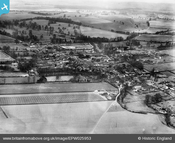
EPW025953 ENGLAND (1929). The town, Buntingford, from the south-west, 1929
© Copyright OpenStreetMap contributors and licensed by the OpenStreetMap Foundation. 2025. Cartography is licensed as CC BY-SA.
Nearby Images (2)
EPW025953

EPW046726

Details
| Title | [EPW025953] The town, Buntingford, from the south-west, 1929 |
| Reference | EPW025953 |
| Date | 3-April-1929 |
| Link | |
| Place name | BUNTINGFORD |
| Parish | BUNTINGFORD |
| District | |
| Country | ENGLAND |
| Easting / Northing | 536128, 229111 |
| Longitude / Latitude | -0.019300298335113, 51.943389722186 |
| National Grid Reference | TL361291 |
Pins
Be the first to add a comment to this image!