
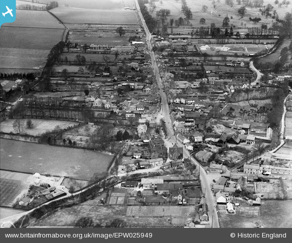
EPW025949 ENGLAND (1929). Market Hill and the High Street, Buntingford, 1929
© Copyright OpenStreetMap contributors and licensed by the OpenStreetMap Foundation. 2025. Cartography is licensed as CC BY-SA.
Nearby Images (4)
EPW025949

EPW025952

EPW046726

EPW025950

Details
| Title | [EPW025949] Market Hill and the High Street, Buntingford, 1929 |
| Reference | EPW025949 |
| Date | 3-May-1929 |
| Link | |
| Place name | BUNTINGFORD |
| Parish | BUNTINGFORD |
| District | |
| Country | ENGLAND |
| Easting / Northing | 536233, 229398 |
| Longitude / Latitude | -0.017659769211427, 51.945943125572 |
| National Grid Reference | TL362294 |
Pins

wazzer |
Friday 7th of September 2012 01:00:06 PM | |
|
wazzer |
Friday 7th of September 2012 12:35:45 PM | |
|
wazzer |
Friday 7th of September 2012 12:35:12 PM | |
|
wazzer |
Friday 7th of September 2012 12:31:17 PM | |
|
wazzer |
Friday 7th of September 2012 12:29:28 PM | |
|
wazzer |
Friday 7th of September 2012 12:15:20 PM | |
|
wazzer |
Friday 7th of September 2012 12:13:41 PM | |
|
wazzer |
Friday 7th of September 2012 12:10:15 PM | |
|
wazzer |
Friday 7th of September 2012 12:09:37 PM |
User Comment Contributions
My grandparent's house, 4 Chapel End. |
state studio |
Tuesday 11th of February 2014 10:33:13 PM |