
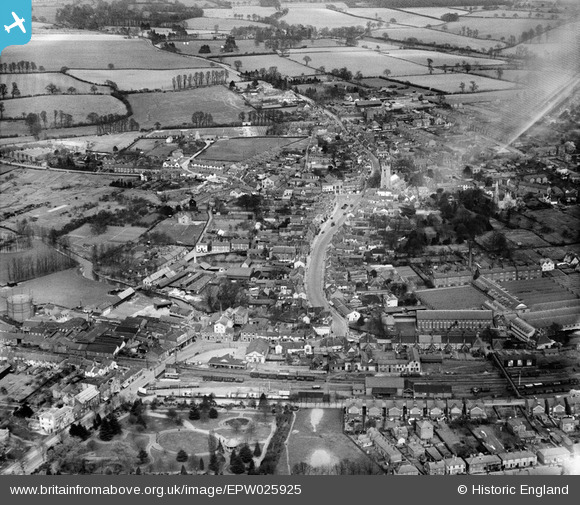
EPW025925 ENGLAND (1929). The town, Halstead, from the south-west, 1929
© Copyright OpenStreetMap contributors and licensed by the OpenStreetMap Foundation. 2026. Cartography is licensed as CC BY-SA.
Nearby Images (4)
EPW025925

EPW025924

EPW025922

EPW025926

Details
| Title | [EPW025925] The town, Halstead, from the south-west, 1929 |
| Reference | EPW025925 |
| Date | 3-April-1929 |
| Link | |
| Place name | HALSTEAD |
| Parish | HALSTEAD |
| District | |
| Country | ENGLAND |
| Easting / Northing | 581170, 230500 |
| Longitude / Latitude | 0.63614872258949, 51.943024033142 |
| National Grid Reference | TL812305 |
Pins

Blake1 |
Wednesday 15th of February 2017 10:53:15 AM | |
|
Steve Willia895 |
Wednesday 3rd of December 2014 07:18:53 PM | |
|
Osprey |
Sunday 16th of November 2014 01:48:59 PM | |
|
michelle |
Sunday 9th of March 2014 10:42:38 PM |