
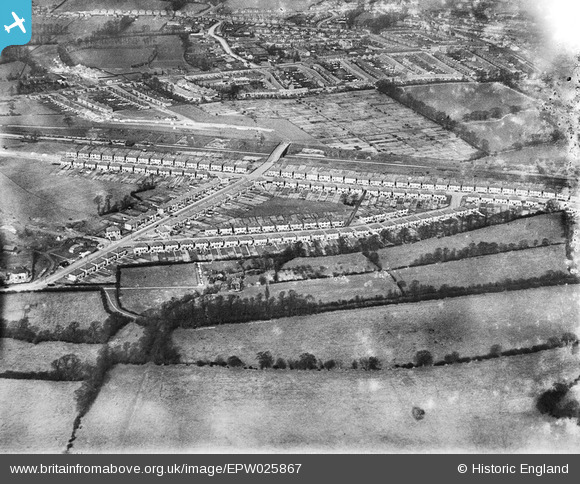
EPW025867 ENGLAND (1929). New housing at Wood End, Northolt, 1929
© Copyright OpenStreetMap contributors and licensed by the OpenStreetMap Foundation. 2026. Cartography is licensed as CC BY-SA.
Nearby Images (11)
EPW025867

EPW025862

EPW025871

EPW025866

EPW025869

EPW025868

EPW025865

EPW025870

EPW025864

EPW025863

EPW060179

Details
| Title | [EPW025867] New housing at Wood End, Northolt, 1929 |
| Reference | EPW025867 |
| Date | March-1929 |
| Link | |
| Place name | NORTHOLT |
| Parish | |
| District | |
| Country | ENGLAND |
| Easting / Northing | 514380, 185481 |
| Longitude / Latitude | -0.34993847862824, 51.556125180875 |
| National Grid Reference | TQ144855 |
Pins

Paul Gleave |
Wednesday 29th of April 2020 03:14:21 PM | |
|
Chriss |
Sunday 3rd of January 2016 03:54:09 PM | |
|
Chriss |
Sunday 3rd of January 2016 03:51:59 PM | |

Class31 |
Friday 28th of September 2012 07:18:10 PM | |
|
Class31 |
Friday 28th of September 2012 07:17:20 PM | |
|
Class31 |
Friday 28th of September 2012 07:16:34 PM | |
|
Class31 |
Friday 28th of September 2012 07:16:02 PM | |
|
Class31 |
Friday 28th of September 2012 07:14:29 PM | |
|
Class31 |
Friday 28th of September 2012 07:13:50 PM | |
|
Class31 |
Friday 28th of September 2012 07:12:58 PM | |
|
Class31 |
Friday 28th of September 2012 07:12:19 PM |