
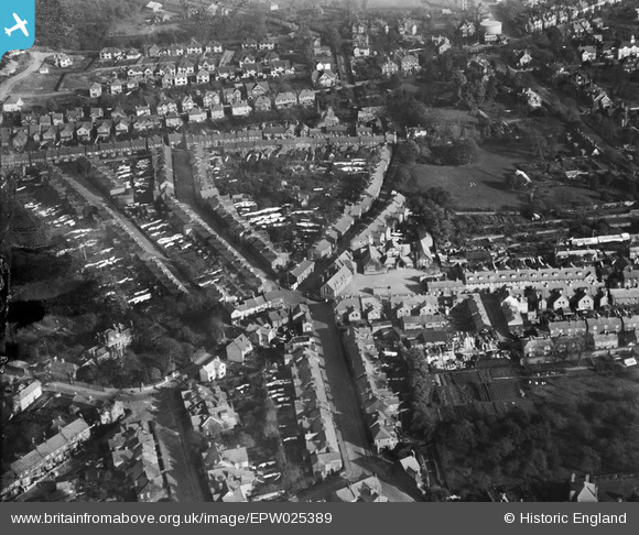
EPW025389 ENGLAND (1928). Housing off Bernard Street and Church Street, St Albans, 1928
© Copyright OpenStreetMap contributors and licensed by the OpenStreetMap Foundation. 2026. Cartography is licensed as CC BY-SA.
Nearby Images (8)
EPW025389

EPW001254

EPW019238

EPW001252

EAW003449

EAW003450

EAW003452

EAW003451

Details
| Title | [EPW025389] Housing off Bernard Street and Church Street, St Albans, 1928 |
| Reference | EPW025389 |
| Date | November-1928 |
| Link | |
| Place name | ST ALBANS |
| Parish | |
| District | |
| Country | ENGLAND |
| Easting / Northing | 514788, 207715 |
| Longitude / Latitude | -0.33675381981789, 51.755892418523 |
| National Grid Reference | TL148077 |
Pins
Be the first to add a comment to this image!