
EPW025364 ENGLAND (1928). High Road, The Green and Woodford Wells, Woodford Green, from the south-west, 1928

© Copyright OpenStreetMap contributors and licensed by the OpenStreetMap Foundation. 2026. Cartography is licensed as CC BY-SA.
Nearby Images (2)
EPW025364

EPW025363

Details
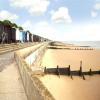
| Title | [EPW025364] High Road, The Green and Woodford Wells, Woodford Green, from the south-west, 1928 |
| Reference | EPW025364 |
| Date | November-1928 |
| Link | |
| Place name | WOODFORD GREEN |
| Parish | |
| District | |
| Country | ENGLAND |
| Easting / Northing | 540058, 192075 |
| Longitude / Latitude | 0.022901120346641, 51.609592622109 |
| National Grid Reference | TQ401921 |
Pins

Michael |
Friday 1st of May 2015 03:37:19 PM | |
|
bazouteast |
Thursday 13th of March 2014 07:48:14 PM | |
|
journeyman |
Friday 18th of January 2013 11:37:16 AM | |
|
journeyman |
Friday 18th of January 2013 11:34:28 AM | |
|
journeyman |
Friday 18th of January 2013 11:32:28 AM | |
Onthecoast |
Friday 21st of December 2012 03:12:06 PM | |

daviddb |
Monday 3rd of December 2012 02:32:16 PM | |
|
daviddb |
Monday 3rd of December 2012 02:30:47 PM | |
Correct about the bank (I had my first job there after leaving school in 1966!) but it's actually now an Indian Restaurant rather than a 'bar' |
Sue |
Thursday 2nd of February 2017 04:03:13 PM |
|
daviddb |
Monday 3rd of December 2012 02:30:15 PM |