
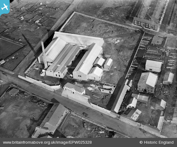
EPW025328 ENGLAND (1928). The Penpoll Tin Smelting Works, Bootle, 1928
© Copyright OpenStreetMap contributors and licensed by the OpenStreetMap Foundation. 2026. Cartography is licensed as CC BY-SA.
Nearby Images (17)
EPW025328

EPW025331

EPW025330

EPW025326

EPW025327

EPW025324

EPW025329

EPW025323

EPW055646

EPW055648

EPW025332

EPW055642

EPW055645

EPW055643

EPW055647

EPW055649

EPW055644

Details
| Title | [EPW025328] The Penpoll Tin Smelting Works, Bootle, 1928 |
| Reference | EPW025328 |
| Date | 3-November-1928 |
| Link | |
| Place name | BOOTLE |
| Parish | |
| District | |
| Country | ENGLAND |
| Easting / Northing | 334416, 396801 |
| Longitude / Latitude | -2.9879795458207, 53.463610255078 |
| National Grid Reference | SJ344968 |
Pins
Be the first to add a comment to this image!